Sedona is walkable for a well-chosen part of your day, but walking will not connect an entire sightseeing trip. Uptown is a good place to leave the car and browse. Tlaquepaque makes another lovely walking destination, and you can connect the two on foot if the distance, hills and weather suit you. West Sedona and the Village of Oak Creek have their own pockets of shops and restaurants, with much longer gaps between the places visitors usually want to see.
The useful question is less “Can I walk in Sedona?” and more “Can I walk from my actual starting point to the places I want to visit?” A hotel near Oak Creek, an Uptown storefront and a red-rock trailhead can all have a Sedona address while offering very different days without a car.
This guide separates pleasant shopping walks from the journeys that need a ride, with named starting points so you can plan your time. There is also a natural gift-shopping detour to Mi Amoré Sedona on Brewer Road, a separate stop from Uptown’s Main Street.
Where Sedona feels comfortable on foot
Uptown: the strongest choice for a short shopping walk
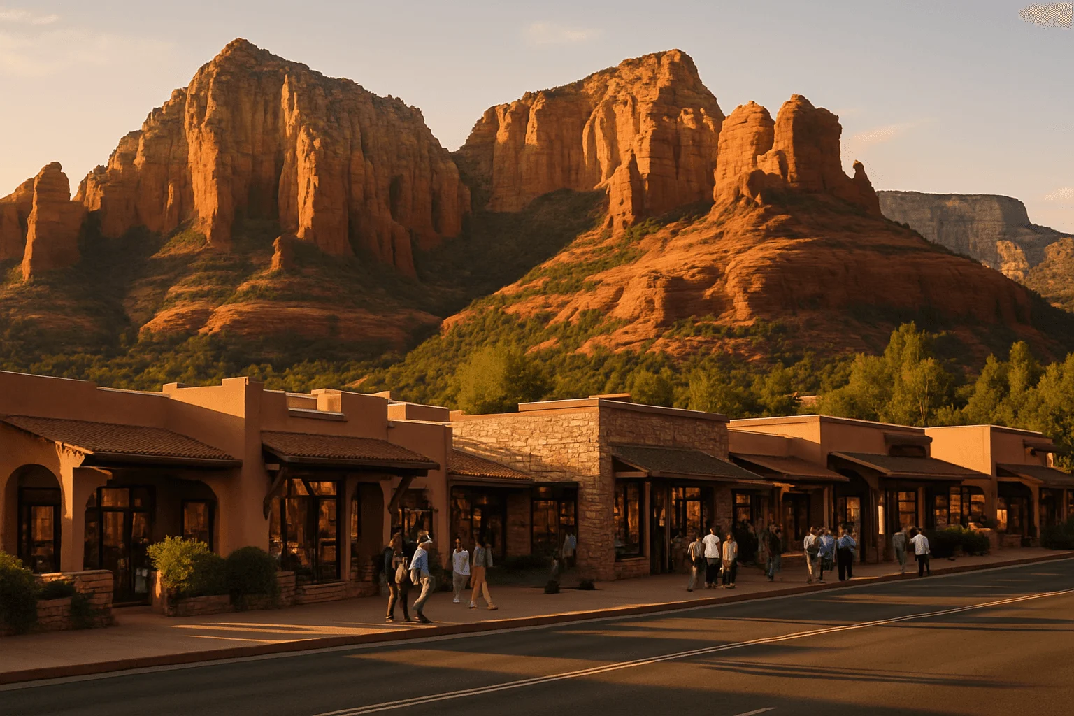
Uptown’s main visitor corridor follows North State Route 89A near the junction with State Route 179, often called the Y. Start around the Visitor Center at 331 Forest Road, then follow the storefronts north toward Sinagua Plaza and the Sedona Arts Center. You can browse, stop for coffee and return along the same corridor without turning the outing into a hike.
Stay on the sidewalks and use the marked crossings when a shop catches your eye on the other side. Uptown is compact, but it is not perfectly flat: routes from creek-level lodging, side-street parking and hotel entrances can include a climb. A short distance on a booking map does not tell you how that return walk will feel after dinner.
The City of Sedona’s Uptown parking and pedestrian map identifies public lots, crosswalks and restrooms. Use a legal space with enough time for your outing; a trailhead park-and-ride is not an automatic shuttle into the shopping district.
Tlaquepaque: a courtyard visit, with a crossing between its two sides
Tlaquepaque South is at 336 State Route 179, and Tlaquepaque North is at 313. The appeal here is the chance to slow down: wander a courtyard, look into a gallery and make room for lunch instead of marching through a checklist. Its official village map helps you find shops and accessible facilities.
There is an Oak Creek pedestrian underpass connecting across SR 179. The city’s explanation of the crossings describes how the underpass and surface crossing are managed. Follow the signed route; the surface crosswalk may close temporarily when traffic builds. Flooding or maintenance can affect the underpass, so use the crossing that is open and designated on the day. Do not follow somebody stepping through a closed crossing just because their destination looks close.
Tlaquepaque lists accessible entrances, parking and restrooms, but that does not establish that every courtyard surface or shop entrance suits every mobility device. Check the village map and your particular destination when step-free access matters. Onsite parking is for village visitors, rather than a base for spending the whole day elsewhere.
West Sedona: choose a small cluster, then ride between clusters
West Sedona stretches along West State Route 89A. A lodging address near the restaurant or grocery store you need can work very well; “West Sedona” by itself is too broad to promise an easy walk. Several short errands in one shopping center feel quite different from following the highway to the next center, crossing driveways and returning uphill.
If your plans alternate between West Sedona and Uptown, use public transit or arrange a ride for that connection. Save your walking energy for the destination. A bus connection leaves more time and energy for the shops, meals and galleries you actually want to enjoy.
Village of Oak Creek: a separate base near Bell Rock
The Village of Oak Creek is south of central Sedona, not an extension of Uptown’s walking strip. Staying there can make sense for nearby meals and Bell Rock-area outings, depending on the exact entrance and route. It does not make Uptown a reasonable shopping stroll.
The Verde Shuttle’s published route serves Cottonwood, West Sedona, Uptown and the northern SR 179 corridor; it does not continue to the Village of Oak Creek. Check the current Sedona Shuttle Connect service map against both addresses rather than assuming that a place with a Sedona mailing address is covered.
Three walks with specific starting points
The distances and times below are Google Maps walking estimates checked September 27, 2026, between the named endpoints. They are one-way navigation estimates, not firsthand timings or an accessibility assessment. Browsing, crossings, heat and a slower pace add time. Check the linked walking directions before leaving, particularly if construction changes the route.
A short Uptown stroll: Visitor Center to Sedona Arts Center
About 0.4 mile, with a map estimate of 9 minutes one way. Begin at the Visitor Center, 331 Forest Road, and follow the North SR 89A shopping corridor toward Art Barn Road and the Sedona Arts Center at 15 Art Barn Road. This keeps the outing focused on Uptown, with room to turn back when you have had enough.
The Arts Center represents more than 100 local and regional artists, so there is a real destination at the end of the walk. Its gallery is open Monday–Saturday, 10am–5pm, and Sunday, noon–5pm. Workshops and special events have their own calendars. If you want a gallery visit rather than a walk past a closed door, time your arrival accordingly.
Use walking directions from the Visitor Center to Sedona Arts Center, and allow separate time to browse. Returning to the starting point doubles the walking distance.
Uptown to Tlaquepaque: a purposeful walk between districts
About 0.5 mile, with a map estimate of 11 minutes one way. These directions start at Pink Jeep Plaza, 204 North SR 89A, and end at Tlaquepaque South, 336 SR 179. They give you a concrete southern-Uptown starting point; a room or parking lot farther north adds its own approach.
Follow the pedestrian route toward the Y and then the SR 179 corridor, using marked crossings and the signed access to your chosen side of Tlaquepaque. This is a connection beside roads, not a creekside promenade. Allow for changes in grade rather than expecting a completely level promenade, and remember that exposed sections can feel longer in the afternoon sun.
It is a good walk when you enjoy moving between districts and have enough energy for the return. If the aim is simply a relaxed courtyard lunch with someone who tires easily, start nearer Tlaquepaque or arrange a ride back. A pleasant visit does not depend on completing both directions on foot.
See the Pink Jeep Plaza–Tlaquepaque walking route. Tlaquepaque’s general shopping hours are 10am–5pm Monday–Thursday and 10am–6pm Friday–Sunday; individual businesses and restaurants can differ.
Tlaquepaque to Mi Amoré Sedona: make Brewer Road its own stop
About 0.2 mile, with a map estimate of 5 minutes one way. From Tlaquepaque South, check the mapped connection along SR 179 and Ranger Road to the Hart Store at 100 Brewer Road. The map approaches the shop from the Ranger Road side; follow the actual signed public access at the destination. Follow public paths and marked crossings instead of cutting through a resort or using a parking-lot shortcut that looks convenient on a map.
Mi Amoré Sedona is a beautifully curated gift shop inside the historic Hart Store, with gifts and home-and-garden finds that make a nice change of pace from a gallery afternoon. It is on Brewer Road, not Uptown’s Main Street. The shop is open every day from 10am to 4:30pm, so make this a daytime stop rather than saving it for after dinner.
Check the walking route from Tlaquepaque to Mi Amoré Sedona. If you drive between stops instead, use parking intended for the business you are visiting.
The three transport services visitors often mix up
Sedona’s transport options solve different problems. Once you distinguish them, a car-free plan becomes much easier to judge: one gets you around within its service area, one follows a fixed corridor, and one takes hikers to selected trailheads.
Sedona Shuttle Connect: a paid ride within a defined service area
Connect is the on-demand option for journeys such as lodging to shopping, dinner or a trailhead park-and-ride. As checked September 27, its dedicated service page lists Thursday–Sunday operation from 6:30am to 8:30pm, a $2 standard fare per rider and an expanded area including the Chapel of the Holy Cross. Extra service days apply during some peak periods.
Request a ride through TransLoc or call dispatch at 928-203-5152. Check both addresses in the service map. Uptown, the Los Abrigados area and Hillside have designated pickup locations, so you may need to walk to the signed point rather than wait outside a particular storefront. The app allows you to indicate a wheelchair when booking.
Look at the current Connect hours and service area before planning an evening around it. A dinner reservation near closing time deserves a clear return plan.
Verde Shuttle: useful for West Sedona and Uptown, every day
The Verde Shuttle is a fixed-route bus connecting Cottonwood and Sedona, with stops through West Sedona, Uptown and the northern SR 179 corridor. The operator currently publishes hourly service, daily from 6am to 10pm, with a $1 fare for rides within Sedona. Read the timetable for your specific stop rather than interpreting those hours as a bus arriving everywhere at 10pm.
This is particularly useful when you want a West Sedona base and an Uptown shopping afternoon without walking between them. Check the route and current timetable in both directions, then build the short walk from the stop into your plans.
Free trailhead shuttles: choose the park-and-ride for your hike
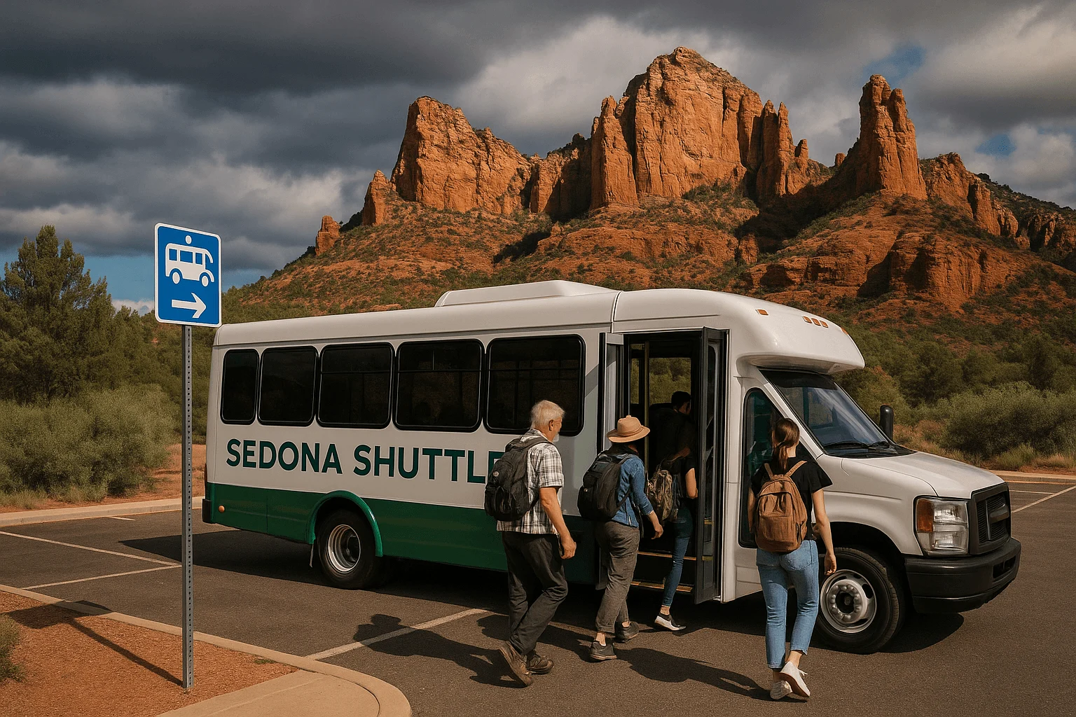
The free trailhead shuttles normally run Thursday–Sunday, with additional days during spring break and selected holidays. They are not a free circulating sightseeing bus through every visitor attraction. No reservation is needed, but you need the right route:
- Cathedral Rock and Little Horse: Route 15 from North SR 179 Park & Ride, 1294 SR 179.
- Soldier Pass: Route 14 from Posse Grounds Park & Ride, 20 Carruth Drive.
- Mescal and Dry Creek Vista: Route 11 from West SR 89A Park & Ride, 905 Upper Red Rock Loop Road. These trailheads provide hiking approaches to Devil’s Bridge, not a drop-off at the arch.
The Cathedral Rock public parking lots close whenever its shuttle is operating. Shuttle passengers do not pay a trailhead parking fee, and the vehicles accommodate wheelchairs; that does not make the hiking routes wheelchair accessible. Check the actual return schedule before walking away from the stop, and finish with a margin before the last pickup.
Our Sedona shuttle guide explains the connections. Use the official route pages and expanded-service calendar for the day you travel. Connect or the Verde Shuttle can help reach some park-and-rides, but the transfer is a separate journey from your Uptown lodging.
Walking to the attraction is different from walking at it
Cathedral Rock: take the right transport, then decide about the climb
Cathedral Rock’s Back O’Beyond trailhead belongs in a separate outing from Uptown shopping. Reach it by the appropriate shuttle or other permitted transport, rather than adding a long road approach to a strenuous hike. The Forest Service describes the ascent as steep and strenuous, with rock scrambling, so “short trail” should not be mistaken for an easy scenic stroll.
If your priority is a view of Cathedral Rock without that climb, choose a viewpoint outing instead. Our Sedona viewpoints guide distinguishes places to enjoy the scenery from trailheads where the main experience still requires hiking.
Chapel of the Holy Cross: a ride solves the approach, not all the walking
The Chapel is at 780 Chapel Road. Plan transport to the property, then account for the uphill approach from parking. The Chapel lists golf-cart assistance, but ask about help for your needs instead of assuming that being dropped off means a completely level visit.
Its published hours are 9am–5pm, with last entry at 4:45pm. Connect’s current service area includes the Chapel, which can help on its operating days; check the pickup point and return plan before relying on it. The Chapel’s visitor information is the right place to confirm arrival details.
Airport Mesa: the overlook and the hiking trails are separate choices
For the Airport Scenic Overlook, arrange a ride or drive to the upper parking area, then use the marked crosswalk to the viewpoint. The airport explicitly says pedestrians must not walk along Airport Road. It is not an appropriate uphill shortcut from West Sedona or Uptown.
The Sedona View connector and Airport Loop are dirt-trail hikes, separate from the brief viewpoint visit. Do not choose the loop simply because somebody describes Airport Mesa as “an easy walk.” The airport’s overlook instructions explain the parking, crossing and trail choices.
Bell Rock: nearby lodging helps, but the route still matters
If you stay near Bell Rock, check the walking route from the lodging entrance to the trailhead before you book. The Bell Rock Pathway has wide, firm sections as well as hills and rough rock; it is not a paved town promenade, and climbing Bell Rock is a different undertaking from walking beside it.
The free trailhead shuttle does not serve Bell Rock. Do not build a car-free Village of Oak Creek stay around an assumed shuttle connection. For choosing the actual walk, use our Sedona hiking guide and the current trail information.
Where to stay if walking is a priority
Choose the part of town that holds your everyday plans. Uptown works well when shops, meals and an Uptown tour meeting point are the things you want outside the door. The northern SR 179/Tlaquepaque area makes more sense if courtyards, galleries and nearby dining are the center of your day. West Sedona can work for a particular restaurant-and-grocery cluster, with transit for the longer connections.
Before choosing a room, map two ordinary journeys: the hotel entrance to dinner, and the entrance to the transport you will use for sightseeing. Check the return as well as the outbound walk. Creekside approaches, hills, crossings and the location of the actual driveway can matter more than an attractive “near Uptown” description.
Our Uptown hotels within walking distance of Main Street guide compares specific lodging locations and their walking tradeoffs, with Expedia booking links alongside the relevant recommendations. A resort well outside your chosen district can still be wonderful, but its scenery does not solve the transport question.
A relaxed half-day on foot, and when to shorten it
For a shopping-focused half-day, begin in Uptown, browse toward the Arts Center and pause for a drink or a gallery visit. If you still want more walking, head toward Tlaquepaque for lunch and courtyard time. Make the Brewer Road gift-shop stop while the store is open, then return on foot or use an available transit connection. You have seen different sides of Sedona without trying to attach a major hike to the same walk.
With a stroller, limited stamina or a mobility device, a smaller plan can be better: choose Uptown or Tlaquepaque, establish the specific accessible route you need, and spend your time there. Do not treat every walking time in a map app as a promise that the surface, incline or crossing will suit you.
In hot weather, shorten the exposed connections and use a ride between districts. Carry water and sun protection even for a town walk; for hiking, read the city’s current hiking preparation advice. After dark, check the route, lighting and transport hours before setting off. Having a planned return lets you enjoy dinner instead of wondering how to get home.
You can have a very good Sedona visit with plenty of walking. The rewarding version is one that matches your starting point, your energy and the day’s conditions, leaving enough time to actually enjoy the places you came to see.
GOOD TO KNOW