You do not have to climb Cathedral Rock or queue at Devil’s Bridge to have a beautiful first hike in Sedona. The better beginner day is often one short route, a little time to look around, and enough energy left for lunch and a wander through town.
Start with Fay Canyon for a gentler canyon walk, Bell Rock Pathway for an adjustable outing, or Crescent Moon for creekside Cathedral Rock scenery. The ten choices below include short versions of longer trails; the distance given describes the outing recommended here, not an invitation to keep following every junction.
“Near Uptown” means these can be planned from an Uptown base, usually with a drive. The Village of Oak Creek and Boynton-area trails are separate trips across town. Distances are approximate, and custom turnarounds are labeled. Easy also does not mean paved, step-free or suitable for a stroller.
West Fork update, September 26, 2026: the Forest Service has extended the closure through October 31, unless rescinded, because of post-fire flood and rockfall hazards. West Fork is not one of the ten currently recommended outings below. Check the official closure order before considering a future visit.
1. Airport Mesa saddle: a short view stop, not the full loop
Start: the small Airport Road turnout below the airport. Walk: the short ascent to the saddle and back, roughly 0.1–0.2 mile depending on where you stop. This is the quick-view version of Airport Mesa, with uneven rock and a little climbing rather than a level stroll.
It works when your group is comfortable with that footing and wants scenery without committing to a whole morning. Stop where the ground feels secure, and keep children away from edges. If climbing rock is not what you mean by easy, use the separate upper Airport Scenic Lookout for a view stop instead.
The Airport Loop is a different hike: about 3.3 miles, exposed sections, basalt boulders and moderate climbing. Starting it from the upper Airport Vista lot adds the Sedona View connector—about 1.2 miles return. Do not turn the short saddle visit into a loop accidentally, or park at the top expecting the lower trailhead to be beside your car.
2. Margs Draw: a shorter walk with room to enjoy the landscape
Start: Broken Arrow trailhead at the end of Morgan Road, off SR 179. Walk: take Margs Draw north for about half a mile, then return for a suggested one-mile outing. This is a deliberately shortened version; the mapped Margs Draw trail itself is about two miles one way.
The Forest Service rates Margs Draw easy. Its open terrain is a good way to enjoy the formations without making a summit the destination. Follow the Margs Draw sign, not the neighboring Broken Arrow route, and use an offline map at the junctions.
Shade is limited, so choose cool conditions. The trail also has access from Sombart Lane and Schnebly Hill; those starting points change the walk. Keep Morgan Road’s trailhead in your navigation if you are following this version.
3. Broken Arrow to Chicken Point: the longer, rockier choice
Start: the same Broken Arrow trailhead at the end of Morgan Road. Walk: about three miles round trip to Chicken Point, with roughly 300 feet of elevation change on the mapped trail. Adding Submarine Rock makes the outing about 3.5 miles according to the Forest Service description.
Broken Arrow is included because its scenery arrives along the way and the Forest Service describes the hike as easy. It is still the more adventurous beginner choice here: open sun, ledges and rocky footing, rather than a flat path. Choose Margs Draw from the same starting area if that sounds like too much.
Follow the signed hiking trail across the Jeep road at the start. Nearby roads carry tours, so a vehicle track is not automatically your walking route. Chicken Point is the destination; the Submarine Rock detour is optional, and turning around earlier is entirely reasonable. This area is in Sedona off Morgan Road, not in the Village of Oak Creek.
4. Jordan–Cibola Pass loop: a real short loop north of Uptown
Start: Jim Thompson trailhead, reached from Jordan Road and Park Ridge Drive. Walk: approximately two miles around the Jordan and Cibola Pass loop, with about 200 feet of gain in the Forest Service’s description.
This is a useful choice if you want a complete loop close to an Uptown base without tackling Brins Mesa. Partial shade and the red-rock front-country setting give it a different feel from Bell Rock’s open corridor. Carry a map and follow the Jordan/Cibola loop rather than adding Soldier Pass or a mesa climb.
The final approach to the trailhead includes gravel, and the loop is still uneven trail. Do not confuse the parking area’s name with a commitment to the full Jim Thompson Trail, which is a much longer return outing. Read posted parking-pass requirements at the lot.
5. Sugarloaf Loop without the summit: enjoy the rocks at their base
Start: Sugarloaf trailhead on Buena Vista Drive in West Sedona. Walk: use Teacup to reach Sugarloaf Loop, circle the base and return by the same connector. Allow roughly 1–1.5 miles total, including access; the loop segment alone is about half a mile.
The point of this version is an easier wander beneath the formations, not climbing every hill in sight. Stay on the loop when the Sugarloaf Summit junction appears. The summit adds a separate climb and can be saved for another day if your group wants to keep things gentle.
The paths connect into a larger network, so it is easy to make a planned short walk longer by following Teacup onward. Keep track of the return junction. This is mostly open terrain: a small loop can still feel hot, and the rocks underfoot call for proper shoes.
6. Lower Chimney Rock loop: a manageable West Sedona circuit
Start: Thunder Mountain trailhead on Thunder Mountain Road. Walk: about 1.4 miles using Lower Chimney Rock Trail and the southern portion of Thunder Mountain Trail, the easy loop described by the Forest Service.
Choose this when you want an actual short circuit rather than deciding on an out-and-back turnaround. The surrounding formations are the attraction, and you can enjoy them without taking the Summit Trail to Chimney Rock Vista.
The summit spur is short but steep, while the Chimney Rock Pass loop is a longer, moderate outing. Follow the lower loop on your map instead of treating all three as the same hike. There is no dependable shade; it is a cool-weather or early-morning choice.
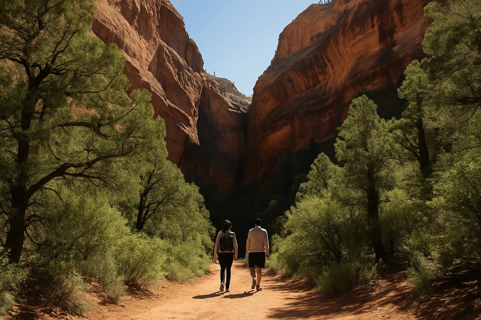
7. Fay Canyon: a gentle route beneath tall walls
Start: Fay Canyon parking area on Boynton Pass Road, with the trailhead across the road. Walk: the maintained main trail, currently listed as 2.1 miles round trip with 144 feet of gain.
Fay is the strongest all-round introduction here for someone who wants a canyon hike without a big climb. The red-rock walls become more enclosing as you move in, so there is a reason to keep looking up and stopping along the way rather than hurrying toward one photograph.
Stay on the main trail and return at its maintained end. The arch detour and scrambling farther up the canyon are separate efforts, not necessary pieces of the easy outing. There can be shade, but the Forest Service warns it can be hot and dry in summer. Use the official Fay Canyon page for current route details.
8. Boynton Canyon’s opening section: choose your own short return
Start: Boynton Canyon trailhead near the junction of Boynton Canyon and Boynton Pass roads. Walk: a suggested half-mile to one-mile outward on the main trail, then return for approximately one to two miles total.
This is an introduction to the setting, not the full canyon hike. The first portion skirts Enchantment Resort before the trail heads farther into the canyon. Stay on the public route and expect open stretches; the deeper wooded sections shown in many photos are not all beside the parking lot.
Boynton Vista is a different spur with climbing toward the spires. If your group wants a gentle walk, remain on the main trail and choose a turnaround before energy runs low. Cave detours and scrambling do not belong in this short version.
9. Bell Rock Pathway: stop before the walk becomes a climb
Start: Courthouse Vista trailhead on SR 179 north of Bell Rock. Walk: follow the signed Bell Rock Pathway toward the formation, turn around after roughly half a mile, and return for a suggested one-mile outing.
You get the recognizable Bell Rock and Courthouse Butte setting without needing to climb the formation. Remain on the pathway rather than following people upward onto the slickrock. There are hills and rough spots even on this shorter walk; the wide surface does not make it an accessible paved path.
The whole Pathway is approximately 3.6 miles one way, and Courthouse Butte Loop is a separate, longer circuit. Those are good reasons to study the kiosk map before leaving. This is a drive south from Uptown toward the Village of Oak Creek, with exposed terrain and little shade. Check the lot’s posted pass instructions.
10. Crescent Moon: Cathedral Rock scenery beside Oak Creek
Start: Crescent Moon Picnic Site, reached via Upper Red Rock Loop Road and signs for Red Rock Crossing. Walk: an adjustable stroll on established creekside paths; budget roughly half a mile to a mile if you want a short visit, turning back sooner if the footing becomes uncomfortable.
Choose Crescent Moon for the combination of water, trees and Cathedral Rock scenery, rather than for a summit or a fixed mileage target. You do not need to cross Oak Creek to enjoy the visit. Shoreline rocks can be slippery, and a reflection depends on water and light conditions—it is not a guaranteed photograph.
The north-side picnic entrance cannot be reached by driving across the creek from Verde Valley School Road. It also has different entry arrangements from ordinary trailhead parking: Red Rock and America the Beautiful passes are not accepted. Use the official Crescent Moon hours and fee information. Opening is 7am April–September, 8am October–November and 9am December–March, so do not plan a pre-opening sunrise visit.
West Fork belongs on a future list, after access reopens
West Fork is a lovely usual option in Oak Creek Canyon, but the current closure takes priority. When it reopens, remember that its maintained three-mile stretch is one way: walking it all and returning is about six miles, with repeated creek crossings. A shorter turnaround can make it manageable, but the stepping stones and water mean it is not a stroller route or a guaranteed easy walk for every beginner.
Check the closure order before planning, rather than relying on an old photograph or a trail app that still describes the normal route.
Make one good hike the center of the morning
A practical first day is Fay Canyon or the Jordan–Cibola loop, followed by lunch and time in town. If you have only a short window, pick Margs Draw’s shorter outing or Bell Rock Pathway. For the creek, choose Crescent Moon during its gate hours. Leave longer extensions for a day when you know how the terrain feels.
On a route through Tlaquepaque and Brewer Road, Mi Amore Sedona in the historic Hart Store is a pleasant change of pace after the trail. Stop at 100 Brewer Road for curated gifts and home and garden finds. It is a Brewer Road stop, not a shop on Uptown’s Main Street; plan it as part of the return through town.
Bring water, sun protection, a charged phone and an offline trail map. Take sturdy shoes even on short routes, allow time for the return and stop well before darkness. Heat, lightning, wet rock and winter ice can change an easy-looking walk. Read the Forest Service’s current alerts before leaving.
Most choices here are natural-surface trails, not verified step-free routes. For walks centered on shops and gentler town paths, see our walkable Uptown guide. If you are bringing a dog, the dog-friendly hiking guide adds pet-specific trail, heat and shuttle details. For a longer hiking day, compare the routes in Best Hikes in Sedona.