Some of Sedona's best discoveries happen when you leave space between the headline sights: a canyon walk without a summit climb, birds gathering around a wetland basin, or a thoughtful gift found inside a historic store. These ten places offer different ways to experience the area, from short town stops to outings that need a full hiking or driving plan.
Several are well known to hikers, and none comes with a promise of solitude. The useful question is which one fits the day you want. Choose Fay Canyon for a shorter maintained walk, the Wetlands Preserve for birdwatching, Palatki for a guided cultural visit, or Mi Amoré Sedona for a relaxed town afternoon. West Fork needs special attention: it is currently subject to a temporary closure, detailed below.
Shorter walks with something different to notice
1. Fay Canyon: enjoy the canyon before considering the arch
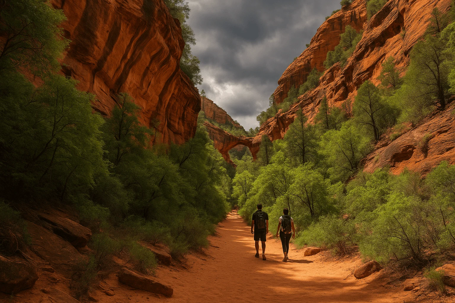
Fay Canyon's sandstone walls make a satisfying outing without a summit. The Forest Service lists the main trail at 2.1 miles round trip with 144 feet of elevation gain. Start from the parking area on Boynton Pass Road, crossing the road to the signed trailhead. The maintained route ends at a sandstone cliff; that is a complete outing in its own right.
The optional arch detour is a separate, steeper informal side trail, not part of that easy-trail rating. If your group includes children or anyone uncomfortable on loose, steep ground, stay with the main canyon walk rather than letting an arch photograph determine the route. It can still be hot and dry here in summer; partial shade is not an excuse to leave water behind. Official Fay Canyon trail information.
2. Sedona Wetlands Preserve: trade rock panoramas for birdwatching
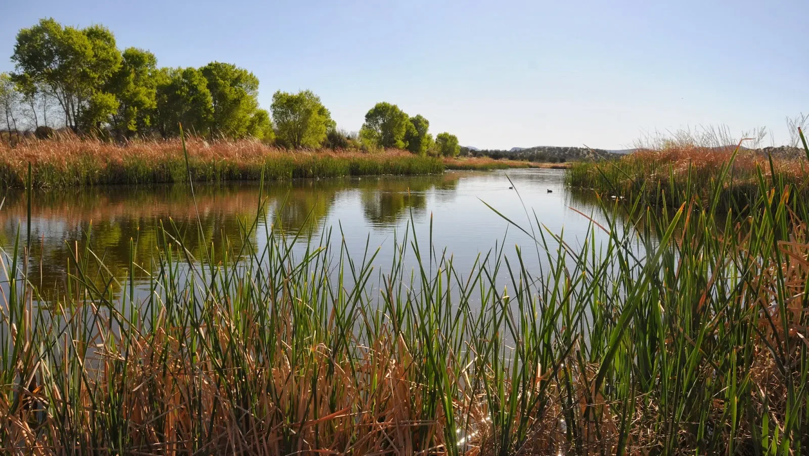
At 7500 State Route 89A, west of central Sedona toward Cottonwood, the Wetlands Preserve offers a different landscape from the hiking postcards. Its roughly 27 acres are part of the city's treated-effluent management system, with six basins designed to support habitat as well as water management. Come for birds and a pedestrian walk, not a swimming hole.
Bring binoculars and take your time at the water's edges. The city recommends morning or evening viewing, quiet observation and keeping your distance from wildlife. Benches and walkways make this a flexible stop: you can enjoy looking without committing to a long canyon hike. Ask the city about the current path surface and approach if you need a specific mobility accommodation rather than assuming every unpaved walkway suits every chair or stroller.
The Northern Arizona Audubon Society offers seasonal free birding field trips. Use the calendar linked from the official Wetlands Preserve page to see whether one fits your visit.
Geology and cultural heritage worth planning around
3. Soldier Pass: a short geological outing within a popular trail
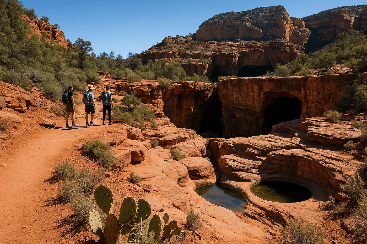
Soldier Pass is not an undiscovered hike. The lower trail is often busy, but it is a useful way to see two distinctive features without committing to the full mesa route. From the signed Soldier Pass trailhead, Devil's Kitchen sinkhole is about a quarter-mile in, followed by Seven Sacred Pools roughly another quarter-mile farther. Returning from the pools makes an approximately one-mile outing, before any extra connector walk.
Water in the pools varies with recent conditions. Enjoy the rock formations even if the pools are not full, and keep back from the sinkhole edge. Continuing toward Brins Mesa creates a different, longer hike with steeper rocky terrain; the Forest Service gives roughly 4–4.5 miles return in different parts of its description. Official Soldier Pass route.
Plan access before driving into the neighborhood. The city's free Route 14 shuttle serves Soldier Pass from the Posse Grounds park-and-ride; trailhead parking is closed to private vehicles while the shuttle operates. Regular service is Thursday through Sunday, with expanded dates at certain holidays. Check the current Soldier Pass schedule and access instructions. A permit for driving the off-road section is a different matter from walking the trail; do not confuse the two.
4. Palatki Heritage Site: reserve a guided visit, not just a parking pass
Palatki protects cliff dwellings and rock images northwest of Sedona. Its guided visit gives the architecture and cultural landscape more context than a drive-by photograph. It is a protected heritage site, so follow the guide and keep hands off walls and rock art; leave objects where they are.
A timed Recreation.gov reservation is required, and your vehicle also needs a Red Rock Pass or qualifying Interagency pass. One does not replace the other. The ticket page advises leaving Sedona at least 1¼ hours before the reservation and arriving 15 minutes early. The gravel approach can be slow and closes when weather makes access unsuitable.
The dwelling visit involves an uneven, strenuous staircase, not a level accessible promenade. Bring your own drinking water; pets cannot go beyond the parking area. The Forest Service also posts a closure threshold above 100°F. Discuss walking limitations before buying a ticket rather than expecting every part of the visit to be equally easy. Official Palatki site details.
Seasonal schedules matter. The Forest Service and Recreation.gov currently disagree on whether September belongs to the summer opening pattern. Use the actual date calendar and confirm with the site if the listed times are unclear; the published schedule otherwise includes shorter summer mornings and a shorter Wednesday in the cooler season. Official Palatki timed tickets and current calendar.
Creekside places with very different effort levels
5. Grasshopper Point: a managed Oak Creek day-use stop
Grasshopper Point, about 2.5 miles north of Sedona on State Route 89A, offers creekside shade and picnic tables. It is a managed swimming and picnic area, so plan around its entry rules rather than assuming a small pull-off is free or uncrowded.
The current fee is $15 per vehicle for up to five people, with $4 for each additional person. Ordinary Red Rock and America the Beautiful passes are not accepted. There are vault toilets but no potable water. Approach northbound for the right turn: the official page says southbound drivers cannot turn left into the entrance and directs them to turn around at Midgley Bridge.
The creek is natural water with changing depths and hidden rocks. The Forest Service discourages cliff jumping and diving; arrive to enjoy the water and picnic setting, not to reproduce a jump from a video. Rocky creek access also makes this a different outing from a flat, supervised children's pool. Official Grasshopper Point fees and access.
6. The Crack at Wet Beaver Creek: a substantial hike beyond town
The Crack is reached by Bell Trail near Interstate 17's State Route 179 interchange, outside central Sedona. It is a beautiful creek destination for hikers prepared for the journey, not a quick Oak Creek swimming stop. Plan on about seven miles round trip to Bell's Crossing; the complete Bell Trail is longer, at 7.4 miles one way.
Start at the actual Bell Trailhead. Bruce Brockett, the first larger parking area along the access road, is a separate start with a connector that adds walking. The Forest Service currently requires a Red Rock or America the Beautiful pass at the trailhead and warns that much of the trail is in full sun with very little shade. Summer temperatures can make this a strenuous outing even though the destination has water.
Carry water for the whole return, food and navigation, and check the forecast for flooding conditions. Swimming is optional; you can enjoy the creek without jumping from its ledges. Wilderness rules prohibit mechanized transport, and camping and campfires are restricted along the creek. Choose this as your major outing, rather than squeezing it between town errands. Official Bell Trail guidance.
7. West Fork: a future canyon walk while the current closure is in place
As checked September 27, 2026, West Fork is closed under Forest Order 03-04-00-26-007, effective September 26 through October 31 unless rescinded. The order addresses precipitation, rockfall and flood-debris hazards after the Pocket Fire. Read the current official closure before planning a visit; the printed end date is not a guarantee of reopening.
When open, West Fork is one of the area's well-known canyon hikes, not a reliably empty secret. The maintained trail extends about three miles one way, giving roughly six miles return if you walk it all, with repeated creek crossings. A shorter out-and-back is possible, but even that requires negotiating the water and rocks; it is not a stroller promenade.
Access is through Call of the Canyon, about 9.5 miles north of Sedona on Highway 89A. It is a concession-operated fee site, distinct from ordinary Red Rock Pass parking. Save this outing for an open, suitable day, and use the official trail page alongside the alert. For a currently available landscape walk, consider Fay Canyon after checking its own conditions; it is a different dry canyon experience rather than a replacement swimming route.
High views, a sacred space and a town discovery
8. Schnebly Hill Vista: the approach is part of the decision
Schnebly Hill Vista overlooks eastern Sedona from the high country. It rewards visitors who have a suitable access plan, but the lower road from Sedona is not a scenic sedan shortcut. The Forest Service explicitly requires a high-clearance, four-wheel-drive vehicle for that rough approach. A rental labeled SUV does not establish the clearance, equipment or permission to drive it.
The official alternative approaches from Interstate 17, Exit 320, then follows about 5.7 miles of forest road to the vista. That is a separate route: reaching the vista from above does not make the rough descent toward Sedona suitable for your car. Seasonal gates and road conditions still need checking before either approach.
There is no drinking water, camping or campfire permission at the vista. Choose the light and weather you can reasonably enjoy while also allowing enough time for the return. If driving rough roads is not the holiday you want, our Jeep tour guide compares operator routes; confirm whether a particular tour actually includes this vista rather than assuming every Schnebly-area tour reaches it. Official vista and road guidance.
9. Amitabha Stupa & Peace Park: a living Buddhist sacred space
The Stupa and Peace Park at 2650 Pueblo Drive in West Sedona welcomes visitors of all faiths for reflection. It is privately owned by a Tibetan Buddhist organization and maintained with donations. Visit with a quiet, respectful attitude; treat people practicing or praying as part of the place, not subjects for your photographs.
Pedestrian visits are allowed dawn to dusk, while the parking lot currently opens 8:30 a.m. to 5 p.m. Access after dark is prohibited. The operator describes a roughly five-minute walk from Pueblo Drive on marked trails and asks visitors needing mobility arrangements to contact it well in advance. A short walk should not be taken as an assurance of a level paved route.
Admission is free, with donations welcomed. Vehicles over 20 feet, including buses and RVs, cannot use the property. Read the official visiting guidance before arriving, particularly with a group or mobility needs.
10. Mi Amoré Sedona: a thoughtful stop in the historic Hart Store
Not every discovery needs hiking boots. Mi Amoré Sedona at 100 Brewer Road offers curated gifts and home-and-garden finds in the historic Hart Store. It is an enjoyable way to slow the afternoon down and choose a reminder of Sedona you will actually enjoy bringing home.
The shop is open daily from 10 a.m. to 4:30 p.m. Fit it into a Brewer Road and Tlaquepaque-area afternoon rather than looking for it among the Uptown Main Street storefronts. A shorter canyon morning followed by lunch and a browse is a more relaxed plan than trying to complete every hike in this guide before the shop closes.
A guided creek walk if you prefer company and local context
For a landscape walk with the route planning handled, Trail Lovers' private Creekside of Cathedral Rock hike is a useful separate option. It explores Baldwin/Templeton terrain below Cathedral Rock, rather than any cave or swimming destination listed above. The operator describes about three miles and roughly three hours walking plus logistics.
The current Viator listing includes a guide, transport from Sedona and Village of Oak Creek accommodations, gear, water, snacks and the parking pass. Day visitors arrange a meeting point. It is not wheelchair accessible, and the operator states that participants need medical insurance. Discuss your group's needs and weather before reserving; Viator's currently listed full-refund cancellation window is up to 24 hours before the experience.
View Creekside of Cathedral Rock hike dates on Viator →
Build a day around one main outing
Fay Canyon plus a town afternoon, a reserved Palatki visit plus a relaxed meal, or Wetlands birdwatching followed by West Sedona are manageable themes. The Bell Trail hike and a rough-road vista trip deserve substantially more of the day. Do not group everything under the word easy just because each destination looks peaceful in a photograph.
Before leaving, read current Forest Service alerts, download the route and carry water and food for the return. Pass rules are site specific: Palatki needs both its ticket and vehicle pass; Grasshopper Point has a separate gate fee; Soldier Pass shuttle access follows the city's schedule. Respect the actual posted rules instead of treating one pass as universal admission.
Our hidden hikes guide goes deeper into trail endpoints and difficulty, while the short scenic drives guide helps if you would rather keep the day closer to paved roads. The best discovery is one you have time and energy to enjoy.
GOOD TO KNOW