
Quick ranking: Easy, Moderate and Hard Sedona hikes
This quick guide ranks popular Sedona hikes by difficulty and gives short stats so you can pick the right route for your day.
Easy hikes in Sedona (gentle, family-friendly)
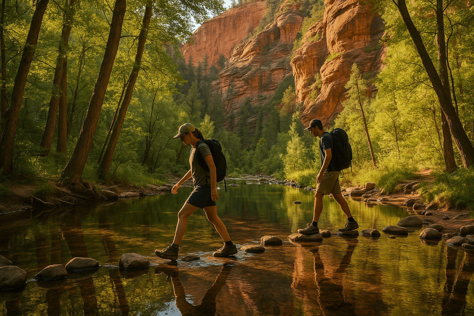
West Fork Trail — Difficulty: Easy. Typically 6–7 miles roundtrip depending how far you go; mostly flat with frequent creek crossings and long shaded stretches. Typical time: 3–4 hours. Parking at the West Fork trailhead in Oak Creek Canyon is limited—arrive early.
Bell Rock Pathway — Difficulty: Easy. Wide, hard-packed pathway along State Route 179 with short loops and access to iconic red-rock views; family-friendly and good for Sedona hikes for beginners. Plan 30–90 minutes depending on route.
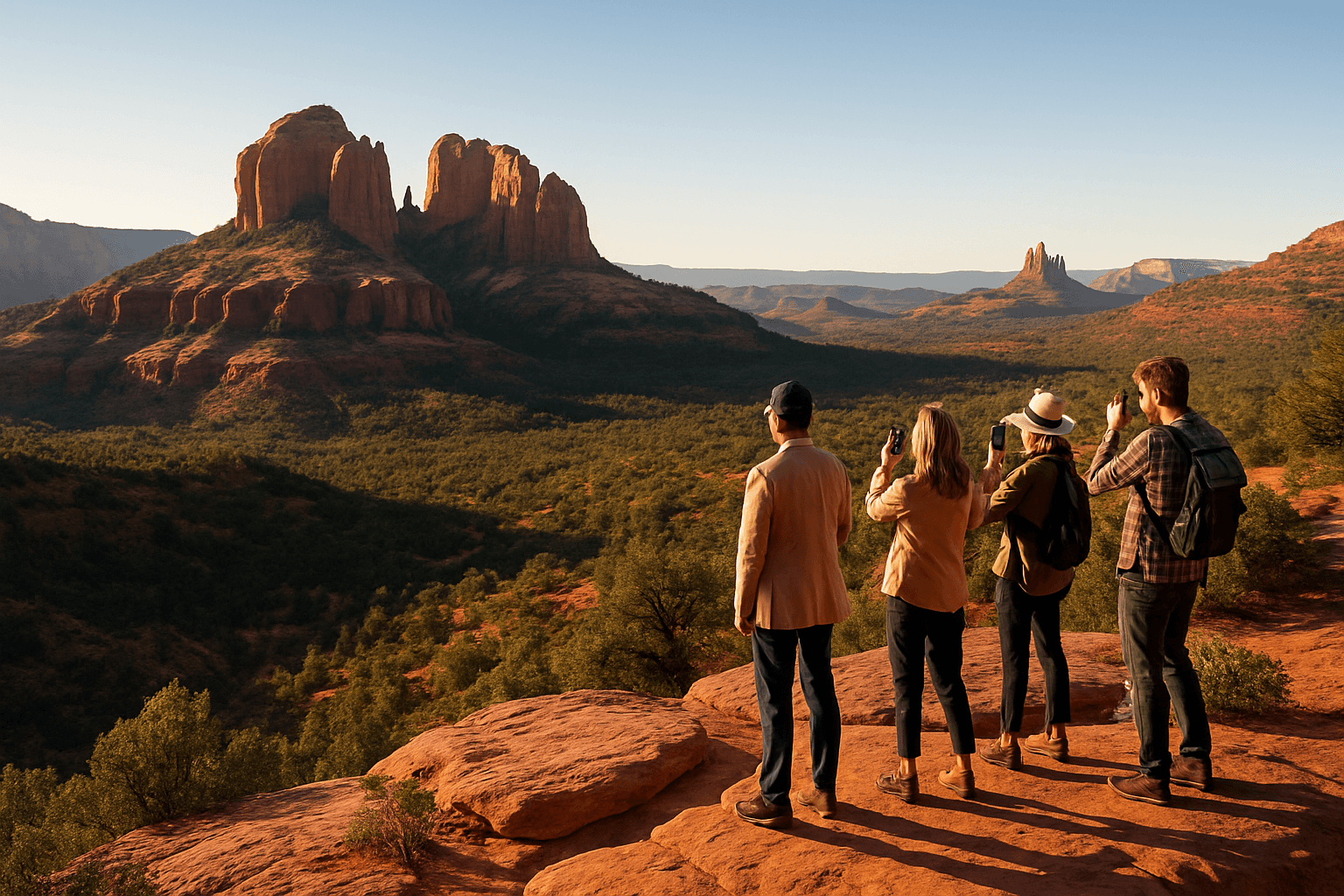
Airport Mesa / Airport Loop Trail — Difficulty: Easy. Short loop and overlook near Sedona Airport that delivers broad panoramic views; popular at sunrise and sunset and convenient for visitors staying in or near Uptown Sedona. Allow 30–60 minutes.
Best for: beginners, families, visitors staying in Uptown Sedona
Timing tip: West Fork stays cooler in summer due to canyon shade; Airport Mesa is ideal at sunrise for wide views
Parking note: Bell Rock has a larger lot off SR 179; Airport Mesa parking fills at sunset
Moderate hikes Sedona visitors enjoy
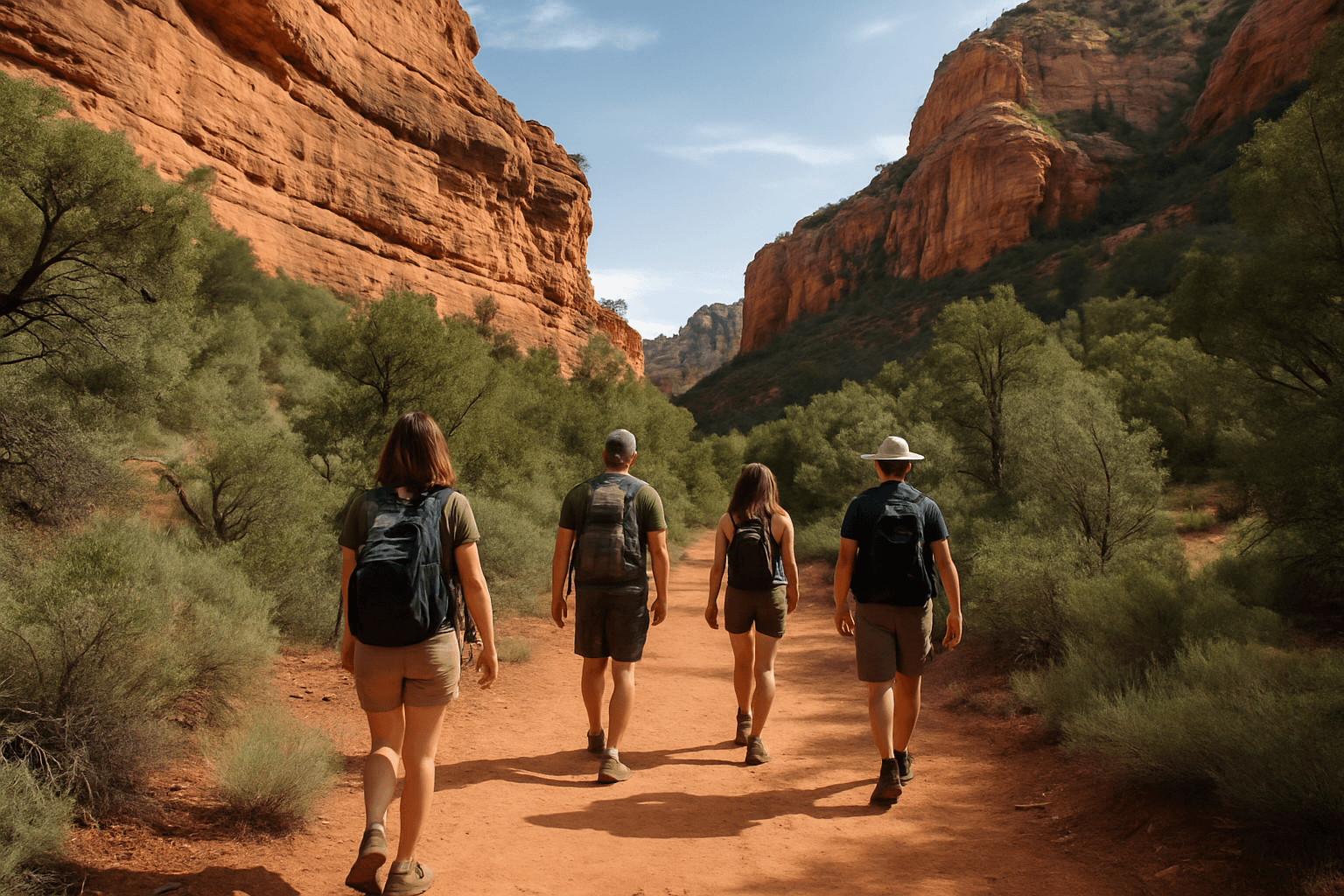
Boynton Canyon Trail — Difficulty: Moderate. Common routing is roughly 6.4 miles roundtrip with varied terrain through a box canyon and a short climb near the canyon. Typical time: 3–4 hours. Trailhead parking fills on weekends—start early.
Devil's Bridge Trail (Trail No. 120) — Difficulty: Moderate. From popular access points the walk to the arch is about 2.9 miles roundtrip; the final approach includes a short scramble. Plan 1.5–3 hours depending on crowds.
Soldier Pass Trail — Difficulty: Moderate. Features include Devil’s Kitchen sinkhole and Seven Sacred Pools; route length varies with chosen loop. Expect 2–3 hours for common outings and limited trailhead parking.
Crowd reality: Devil's Bridge is a busy photo spot—arrive well before midday for easier parking
Access tip: Boynton Canyon delivers canyon walls and a quieter feel than the most photographed overlooks
Hard or exposed hikes in Sedona (short but steep)
Cathedral Rock Trail (USFS Trail No. 170) — Difficulty: Hard for its grade. Short but steep with exposed rock-scramble sections and little shade; allow 30–90 minutes depending on fitness and photo stops. Use caution on slick or wet rock.
Doe Mountain Trail — Difficulty: Easy–Moderate. Short climb to a mesa top with roughly 400 feet of ascent; the mesa offers dramatic 360° views. Popular at sunset; parking is shared with nearby trailheads and can fill quickly.
Technical note: Cathedral Rock’s final sections require hands-on scrambling—avoid in wet conditions
Best for: hikers comfortable with exposure and short steep climbs; not recommended for those with limited mobility
Trail-by-trail logistics: parking, crowds and timing
Practical details that affect your hike day—where to park, when crowds peak, and trail-specific notes.
West Fork Trail and Oak Creek Canyon planning
West Fork’s creek crossings and shaded canyon make it a cooler choice in summer and a photographer favorite. Trailhead parking is limited—arrive at first light or combine with a stay in the Village of Oak Creek.
Bring quick-dry shoes if you plan to walk streambed sections; shorten the route by turning around after the first scenic cascades to save time.
Best time: morning to avoid heat and crowded parking
Nearby: West Fork sits inside Oak Creek Canyon—pair with a scenic canyon drive or an afternoon in Uptown Sedona
Devil's Bridge, Bell Rock and Airport Mesa—crowd management
Devil's Bridge draws large visitor numbers because of the arch photo opportunity; parking near Dry Creek / Mescal Road is scarce midday. For fewer people, go at sunrise or on a weekday afternoon.
Bell Rock Pathway is a flexible alternative for iconic red-rock views without scrambling. Airport Mesa gives quick panoramic views close to Uptown Sedona when time is limited.
Suggestion: Pair an easy hike (Bell Rock or Airport Mesa) with shopping or a quick stop at Mi Amore Sedona in the historic Hart Store
Photo tip: For Devil’s Bridge and Cathedral Rock, aim for first light to avoid long photo lines
Soldier Pass, Boynton Canyon and Doe Mountain access notes
Soldier Pass includes multiple highlights—Devil’s Kitchen and Seven Sacred Pools—but the trailhead is small and often busy. If lots are full, consider a nearby route.
Boynton Canyon is a solid moderate choice for a mid-length outing without technical scrambling. Doe Mountain’s mesa top is popular at sunset; arrive early for parking.
Timing: Late fall through spring offers the most comfortable daytime temperatures
Navigation: Carry an offline map or printed trail map if you plan side trips from Boynton or Soldier Pass
Well-Reviewed Places to Stay Near Sedona Trails
If easy access to trailheads matters most, these are some of the better-known and well-reviewed lodging options to look at while planning your Sedona trip.
Enchantment Resort - 4.5/5 (2,000 reviews)
Check ratesL'Auberge de Sedona - 4.4/5 (1,800 reviews)
Check ratesAmara Resort and Spa - 4.3/5 (1,170 reviews)
Check ratesThe Wilde Resort & Spa - 4.4/5 (508 reviews)
Check ratesAmbiente Sedona - A Landscape Hotel - 4.8/5 (274 reviews)
View on Google MapsEl Portal Sedona Hotel - 4.7/5 (303 reviews)
Check rates
Planning, safety and visitor rules for Sedona hikes
Basic precautions and local rules to keep your hike safe and enjoyable.
What to carry and wear for Sedona hikes
Water: Carry at least 1 liter per hour in warm months. On West Fork expect creek crossings—bring sandals or quick-dry footwear; on Cathedral Rock use sturdy shoes with good grip for scrambling.
Sun and temperature: Bring sun protection and dress in layers—Sedona can heat quickly, even on short easy hikes like Airport Mesa.
Navigation: Download an offline map or carry a printed trail map for Boynton Canyon and Soldier Pass if exploring side routes
First aid: Pack basic supplies and respect your limits on steep sections
Dogs, permits, parking passes and closures
Dogs: Many USFS trails allow dogs on leash, but conditions vary—keep pets leashed on Bell Rock Pathway and Airport Mesa and avoid hot rock in summer.
Permits & parking: Some lots and recreation areas may require passes or fees. Check posted signs at trailheads for up-to-date parking or shuttle details before you go.
Trail conditions & closures: Trails such as Cathedral Rock (Trail No. 170) and Devil’s Bridge (Trail No. 120) are managed by the USFS; seasonal closures or restoration work can occur—follow posted notices.
Practical step: If a trailhead lot is full, choose a nearby alternative such as Bell Rock or Airport Mesa
Local tip: For maps or local guidance after a hike, visit Mi Amore Sedona in the historic Hart Store in Uptown Sedona
Choosing based on your group and schedule
Beginners and families should favor Bell Rock Pathway, Airport Mesa and shaded stretches of West Fork Trail—these are the easiest Sedona hikes for beginners with short turn-around options.
If you have a half day and moderate fitness, Boynton Canyon or the route to Devil’s Bridge provides a satisfying moderate hike. Save Cathedral Rock and other short steep scrambles for when your group is comfortable with exposure.
Best midday options in summer: West Fork because of shade and creek access
If staying in Uptown Sedona and want a short walk before shopping: Airport Mesa is the nearest quick viewpoint
Amazon Products to Make Your Trip Better


Wrap up: Plan wisely, pick one route and enjoy Sedona
Match trail difficulty to your group's fitness, schedule and parking tolerance. Use the ranked list to choose a hike you’ll complete comfortably.
Suggested one-day plans using these ranked hikes
Half-day beginner: Sunrise at Airport Mesa followed by coffee and a walk in Uptown Sedona with a stop at Mi Amore Sedona.
Moderate day: Start early at Boynton Canyon, picnic near the canyon mouth, finish with a short loop on Bell Rock Pathway in the afternoon.
Short but intense: Early visit to Cathedral Rock—go before crowds, take care on scrambles, then recover with a leisurely stroll in Uptown Sedona.
Have a backup plan: If parking is full, choose Bell Rock or Airport Mesa as nearby alternatives
Respect USFS notices and seasonal rules to help keep these trails open
Where to go next for local info
For printed maps, local recommendations, or questions about trail access after a hike, visit Mi Amore Sedona in the historic Hart Store in Uptown Sedona.
For current trail notices or official updates, check USFS postings at trailheads before you hike.
Keep your itinerary flexible and allow extra time for parking and photos
If you need official updates, consult USFS resources for Trail No. 170 (Cathedral Rock) and Trail No. 120 (Devil’s Bridge)
Related Sedona Guides
Best Sedona Trails for Kids: Easy, Short & Safe Hikes Near Uptown
10 Easy Hikes Near Uptown Sedona With Epic Views (Beginner-Friendly)
Best Dog‑Friendly Hikes in Sedona (2026 Guide): Trails, Rules & Safety Tips
Local Tips Before You Go
Sedona trails are beautiful, but a little planning goes a long way, especially during busy seasons.
Start earlier than you think on popular trails because parking lots can fill fast, especially in spring, fall, and holiday weekends.
Bring more water than feels necessary because Sedona’s dry air catches people off guard even on short hikes.
If you want a less hectic experience, weekday mornings usually feel calmer than midday weekends around the most famous trailheads.

Planning your Sedona visit? Here are answers to common questions about shopping in Sedona and finding meaningful Arizona gifts at Mi Amore Sedona. We look forward to welcoming you in.